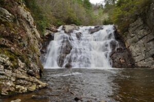
If you are looking for a great way to spend a summer day and want to see some of the most majestic nature in all of Tennessee, then you need to hop out of your car and take a scenic hike to Laurel Fork Falls in Carter County. Locals just call the falls Laurel Falls and it is the perfect place for a family outing and as long as you are in decent shape physically, the trail hike to the falls is pretty serene and not difficult to hike at all. To get to Laurel Falls you will take 321 to Hampton from Elizabethton, Tennessee and follow signs to get to Dennis Cove Recreation Area. The road to Dennis Cove is a very steep and winding road going up the mountainside. The falls are a beautiful 55 feet tall sheet of rushing water and regardless of the time of year, the natural beauty surrounding the area is surreal.

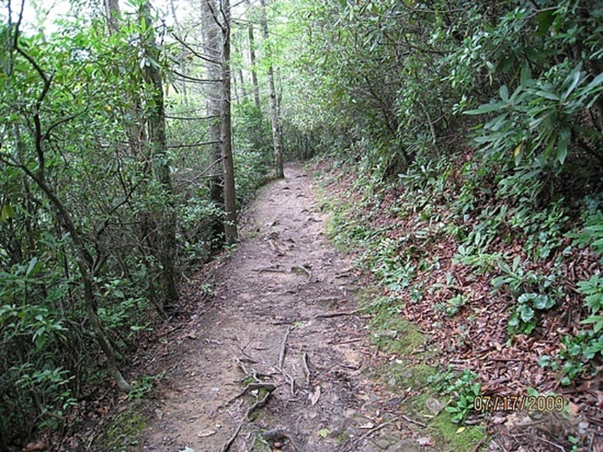
When you park your car at Dennis Cove Recreation Area in Hampton you will see the trail head right at the edge of the main parking lot. Once you begin walking down the trail you will quickly see that it is fairly flat and wide enough for two people to walk side by side. As soon as you hit the Laurel Fork trail, you will most likely notice signs letting you know that bears may be in the area and to be careful. This trail is, by the way, part of the Appalachian Trail and it is a beautiful area. In all the years that I’ve been hiking to Laurel Falls in the summer, I have never seen a bear. I usually don’t head up to the falls until well into the summer though and bears tend to be more active during the spring so this may be why I’ve never seen one. Some people may find bears intriguing but as for me, I happily avoid them whenever I can when hiking.

There is a great little spot to camp on the right when you first get on the trail. It’s soft ground and is usually covered with pine needles. There is also a swimming hole right next to the pine trees. We have seen a few snakes at the water here, but it has never stopped us from splashing around for a few minutes when we begin the hike. This is the wilderness and snakes are expected just as much as spiders, bugs and even bears may be. If you enjoy camping in the wild, this is a beautiful area to camp.

Once you hike down the trail for about a mile, you will come across a small wooden footbridge. If you are feeling a little tired or hot you are in luck at this point as there is a great little wading pool just beneath the bridge. This is a great place to hop in the water and cool off for a little while before you head across the bridge and on down the trail to the falls. Every time I go to the falls with my kids, we always stop and splash around for a few minutes before we finish the hike. The water is cold, but on a hot summer day it feels amazing to just lay back in it and cool off.


Once you finish splashing around in the water by the bridge, it’s time to head on down the trail toward the falls. The rest of the hike is not on flat terrain as the first mile is but it really is not too difficult at all until you get to the falls. Once you arrive at the top of the falls you will see a sign that is says Laurel Falls and High Water Route. You are going to take the path in the direction of Laurel Fork Falls. I’ll give you fair warning now. The hike down to the falls is very steep and you will be climbing down a set of extremely rugged stairs until you get to the bottom. The long walk to the bottom is well worth it when you get to the bottom and see the beautiful falls and the large pool at the bottom of the falls.


The falls are breathtaking and most people spend hours playing in the water beneath the falls once they arrive. We have met tourists from Sweden, Germany and Japan as well as people from all across the U.S. during our hikes to the falls. This area was once a place that only locals knew about and it is pretty nice to know that people from so many other areas of the world have found our little piece of Heaven and they all seem to really enjoy it as much as we do. It is also nice to know that even with the tourists, the falls are usually pretty quiet and we have never seen an excessive number of people on the trail or at the falls when we have been. The falls are beautiful and the top of the falls is a great place to sit back and just watch the surrounding woodland area. We have seen many small forest animals while sitting at the falls including squirrels and some pretty amazing colorful birds. It’s a good idea to pack a light lunch and enjoy it once you get to the falls. Be sure to take your trash with you as there is nowhere to dispose of garbage on the trail or at Laurel Fork Falls.
If you want as smoother spot to swim you can hike down past the falls and will eventually run into a sandy bottom swimming hole just beyond a small patch of tall rocks. Since this area is past the falls, it is usually pretty isolated from other people and if you are lucky, you can really enjoy the peace and quiet for hours on end. We usually stay at the falls and spend the day just relaxing and splashing around in the water. The only thing that we have found difficult about hiking to Laurel Fork Falls is the steep hike back up to the main trail when you are leaving the falls. It is definitely a strain to get back to the top after a long day of swimming and playing in the water below. No matter how many times I have been to the falls, I always have to take a break halfway back to the top and rest for a minute. Rest breaks are great though as they give you plenty of time to take in the scenic beauty surrounding you and really appreciate this world we live in.
Be sure to take plenty of water when you are hiking to Laurel Fork Falls. The hike itself is not that long, but the heat in the Tennessee woods can be very draining and water is a must.
Directions to Laurel Falls
From Johnson City, TN
Take US-321 N/TN-67/TN-91/Broad St. (8.35 miles)
Turn right onto Highway 19 E/US-321 S/US-19E S/TN-67/TN-37. Continue to follow US-321 S/US-19E S/TN-67/TN-37. (5.17 miles)
Left onto Highway 321/US-321 S/TN-67
Follow signs to Dennis Cove Recreation Area
Turn slight right off of US-321 towards Dennis Cove and follow the winding road until you get to the recreation area. Park in the lot on the right side of the road at the recreation area and the Laurel Fork trail head is adjacent to the parking lot. If the main lot is full you will find an overflow parking area across the street from the recreation area.


Leave a Reply